122
Deutscher Schulatlas
The Nazi School Map
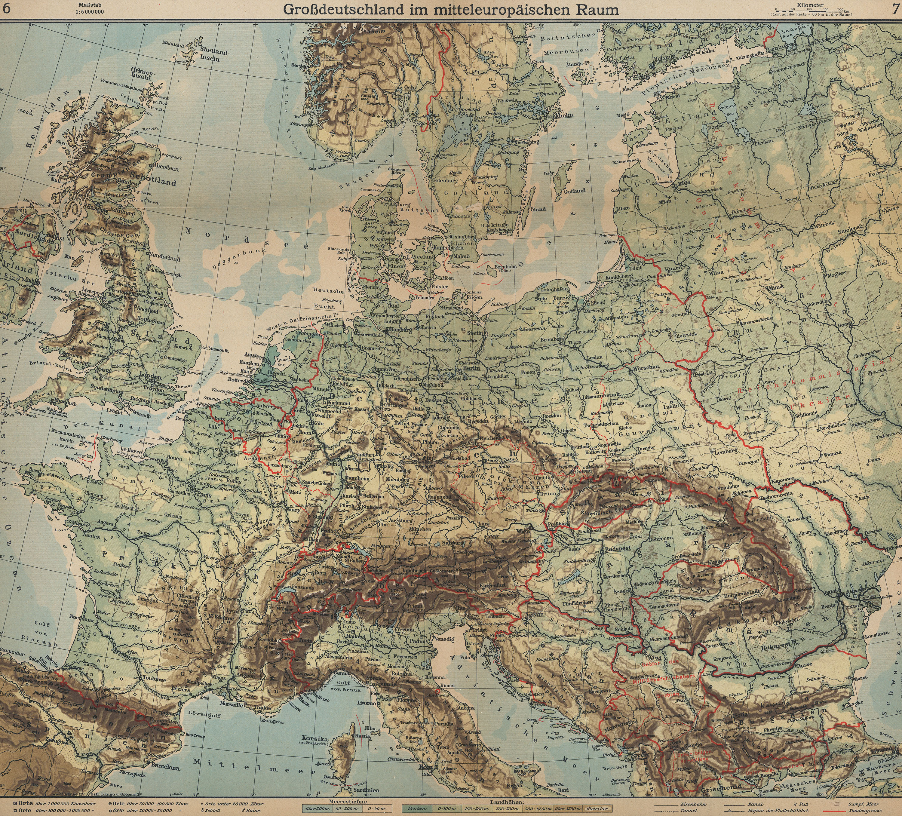
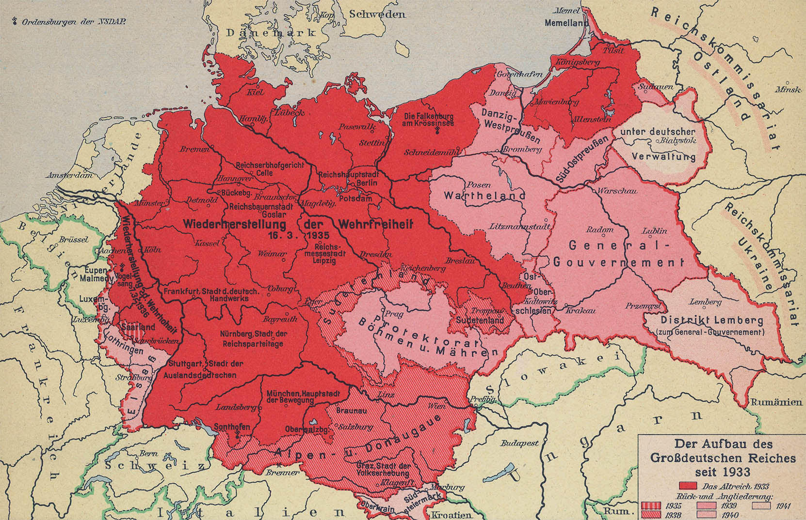
This is the Großdeutschland im mitteleuropaischen Raum, from pages 6–7 of the first edition of the Deutscher Schulatlas. On first glance this map of Central Europe, with it’s typical hypsometric/bathymetric tinting, looks like any other school map. However note the national borders (in red) and the country names (Deutsches Reich, Frankreich, Reichkommissarial Ukraine, e.g.) – it was the extent of the Third Reich on 10 Jan 1942. It was a primary-school introduction to Lebensraum.
After seizing power in 1933 the Nazi’s immediately set out to “reform” German education and integrate their National Socialist ideology into the curriculum. As Hans Schemm, leader of the Teacher’s League stated: “Those who have the youth on their side control the future.” Bernhard Rust, the Reich Minister for Science, Education and Popular Culture, was ever more blunt: “The whole function of education is to create Nazis.”
Eventually all school subjects were taught with specific, often military, goals: biology emphasized eugenics and racial purity; sports were to instill discipline and endurance; mathematics taught artillery range-finding; chemistry and physics explained the synthesis and properties of explosives (and, while they were at it, refuted Einstein's flawed “Jewish” physics).1
Geography, too, was “reformed.” It taught the importance of the of German Fatherland (“blood and soil”) and Lebensraum – the idea that Germany deserved more living space and needed to reclaim German lands ceded in the Treaty of Versalles. Hitler considered the "conquest of Lebensraum in the East and its ruthless Germanization" to be his most important foreign policy objective.2 More practically map-reading was seen as as essential military skill. By 1938 two hours/week of geography was mandated in secondary schools.
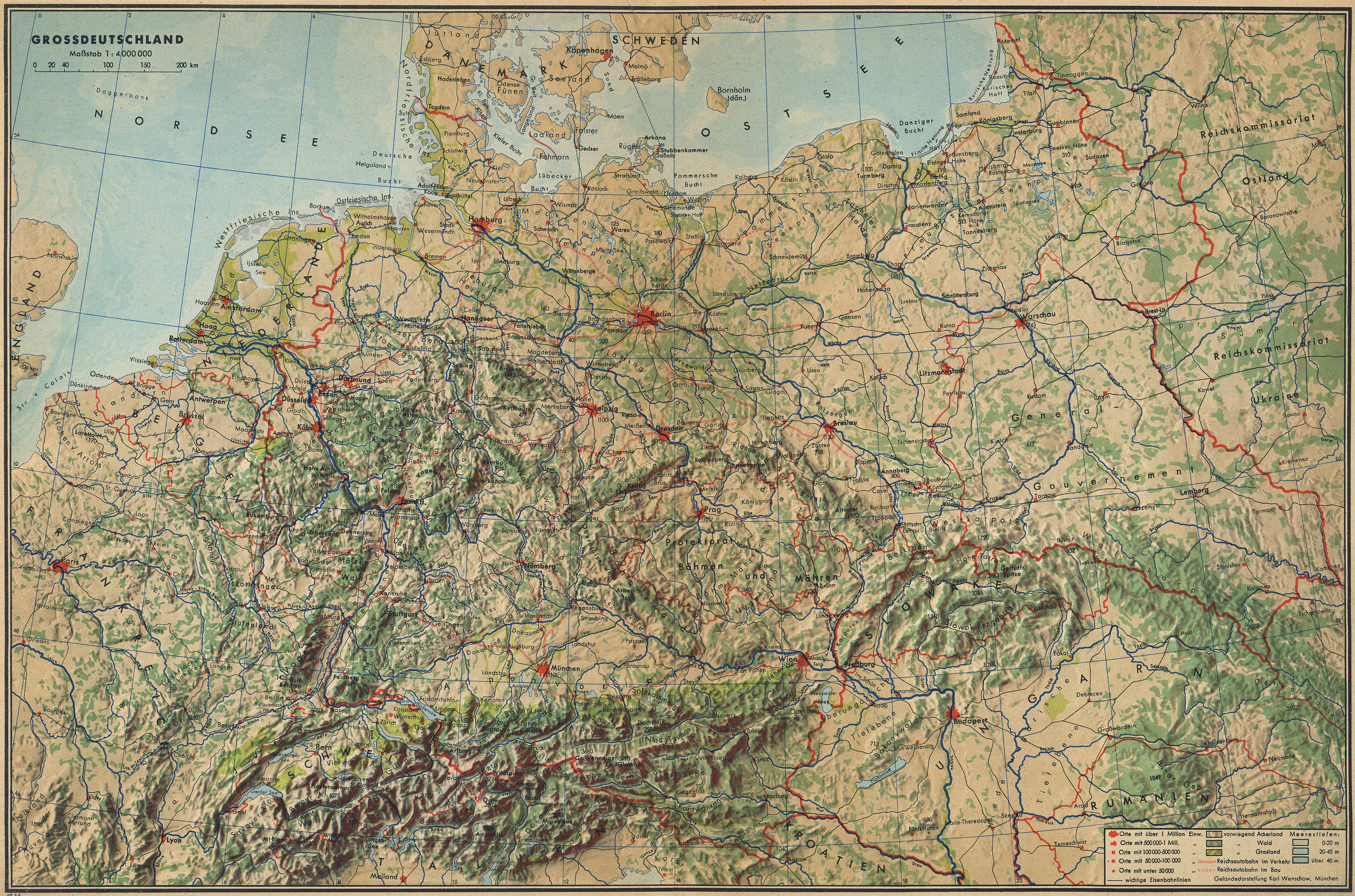
Grossdeutschland
The first edition of the Deutscher Schulatlas was published in Sep 1942 under the auspices of the Reichsstelle fur Schul- und Unterrichtsschrifttum (the office responsable for school-book censorship) by the Gemeinschaftsverlag Deutscher Schulatlas-Verleger.3 It was, according to the introduction, “... a people's atlas, drawn from available material, that takes into account the necessities of war and, for the first time, the current political situation of our age.”
Most of the cartography was by the venerable firm of Georg Westermann, which had published school maps, including the seminal Diercke Schul-Atlas, since the middle of the 1800s.
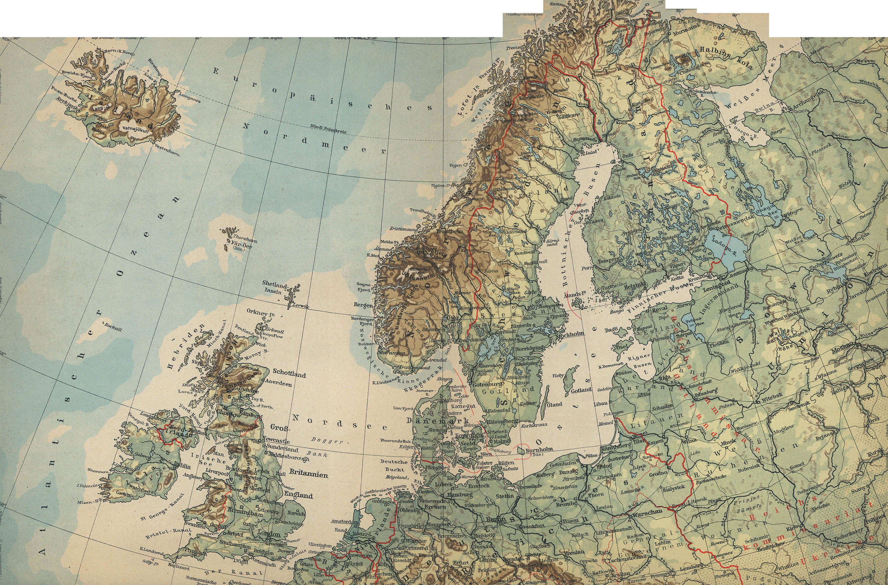
Nord- und Ostseelander – Nordeuropa
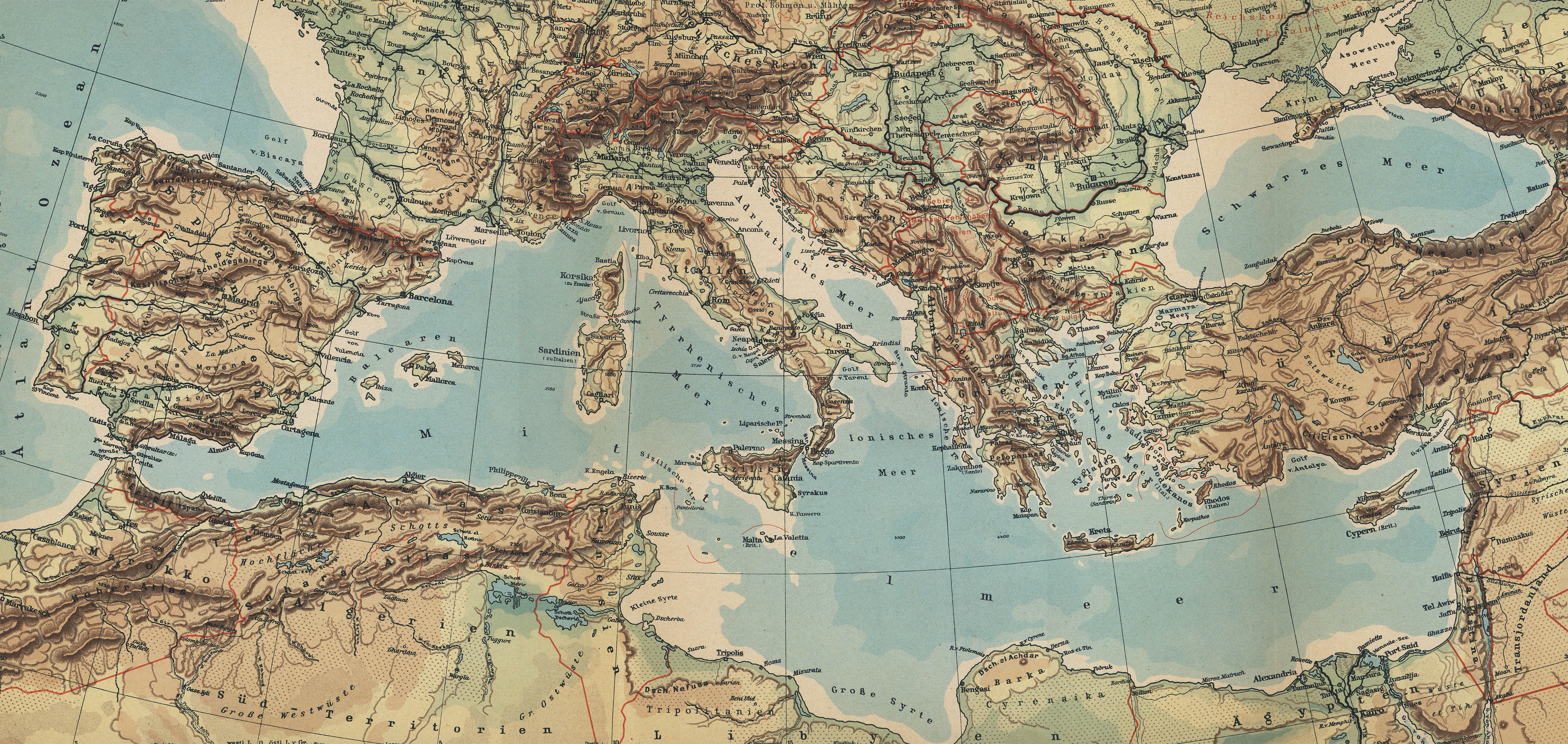
Mittelmeerlander – Südeuropa
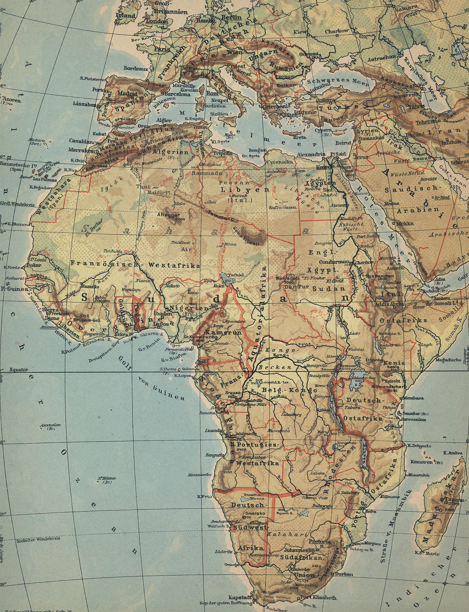
Afrika
Virtually every thematic map in the Atlas reinforced the concept of Lebensraum:
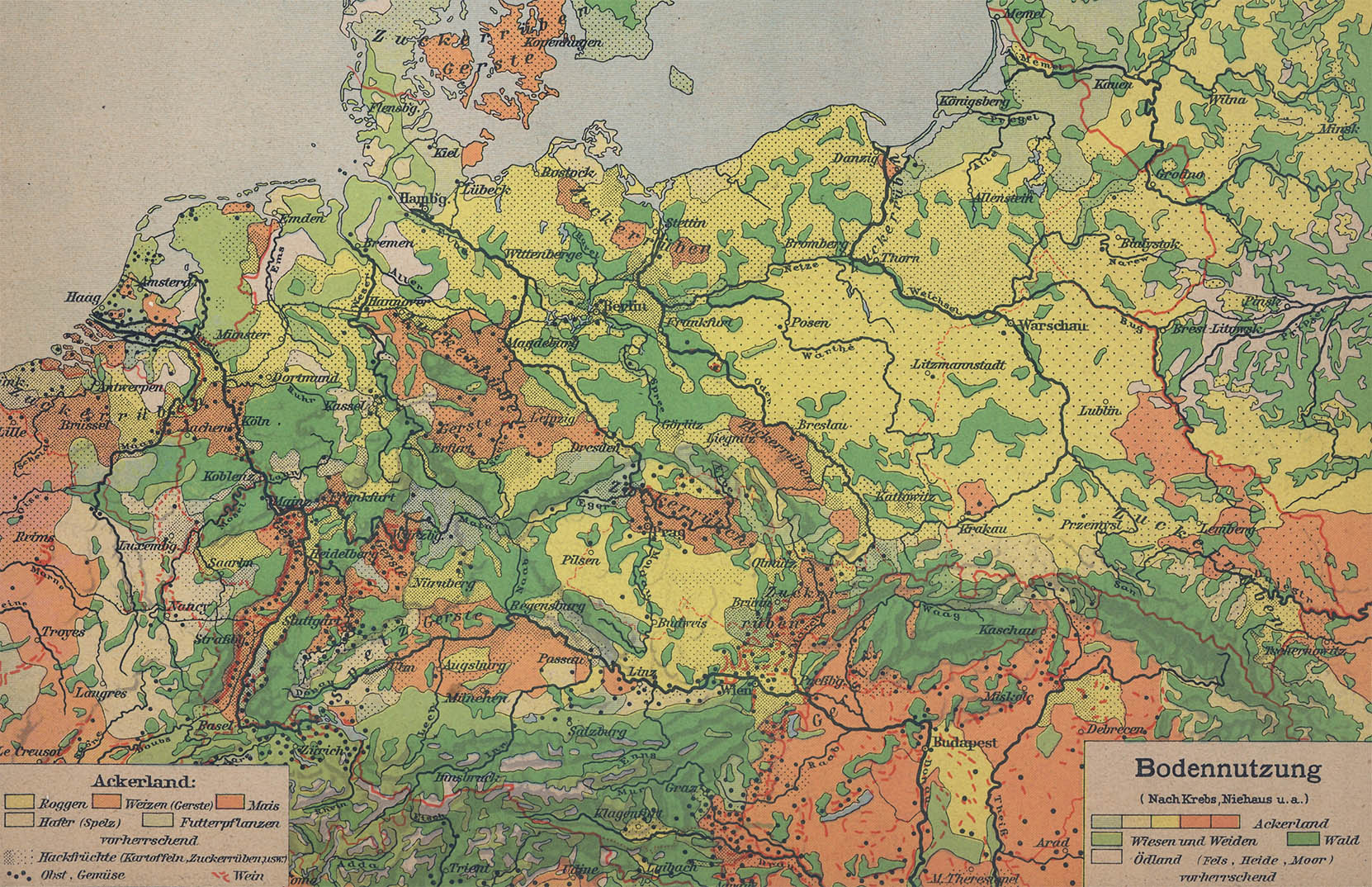
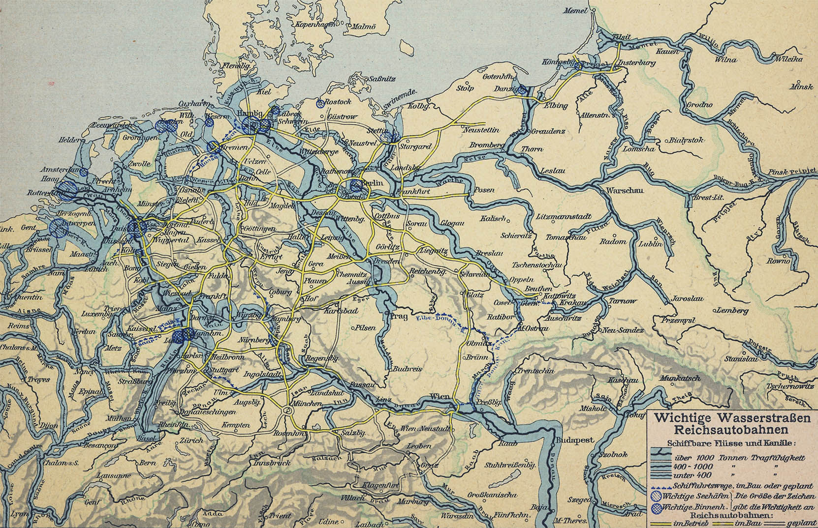
Großdeutschland als Lebensraum
Presumably to save costs and conserve paper, more detailed 1:800,000 maps of Germany were divided among a series of regional Atlases. Here are a few examples from the Heimatteil Gau Baden Atlas:4
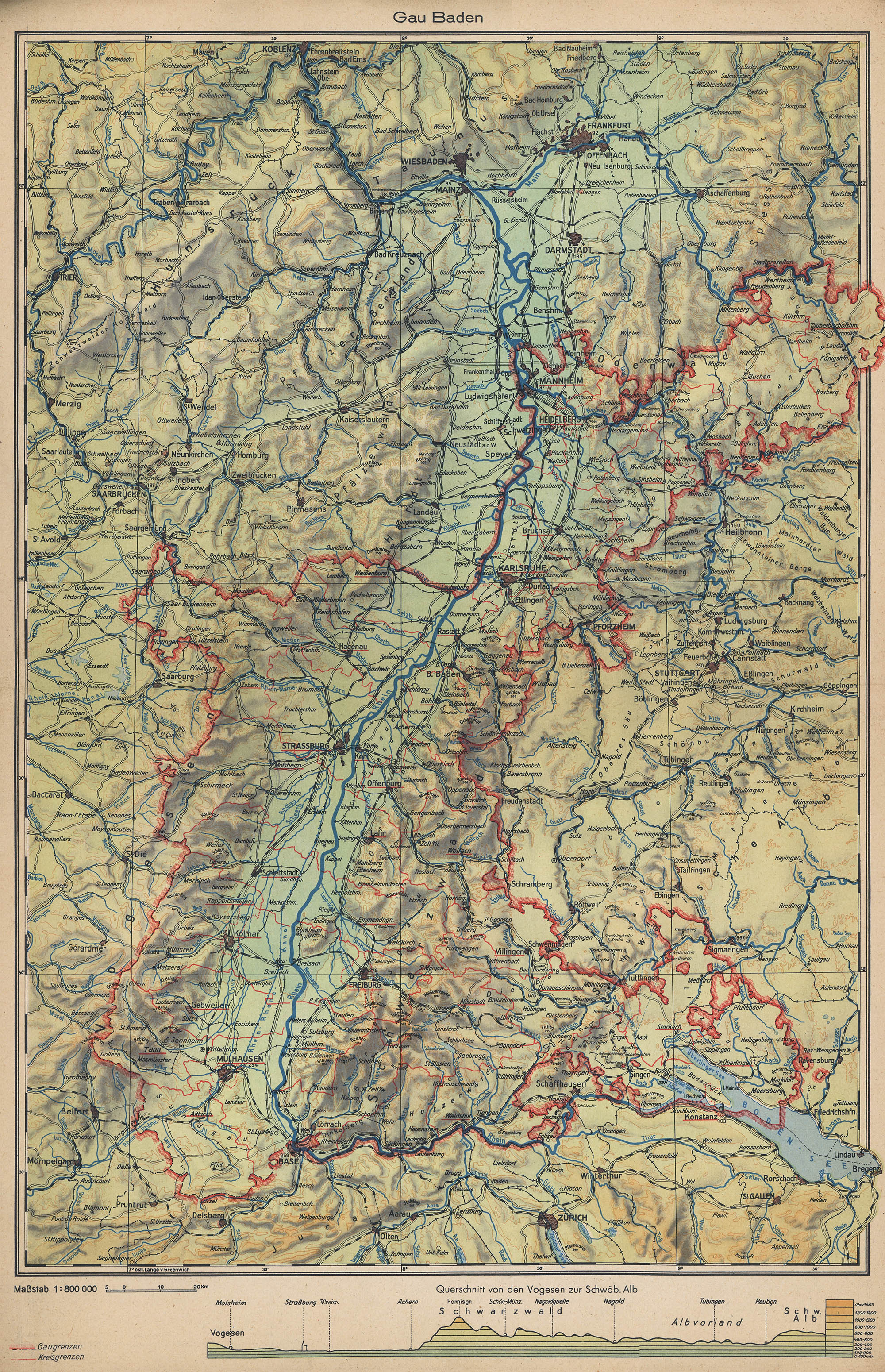
Gau Baden
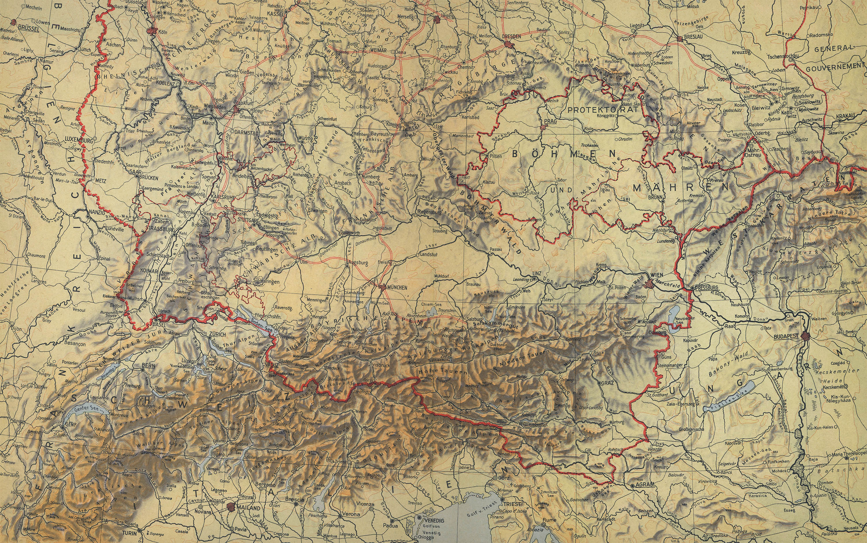
Oberdeutschland
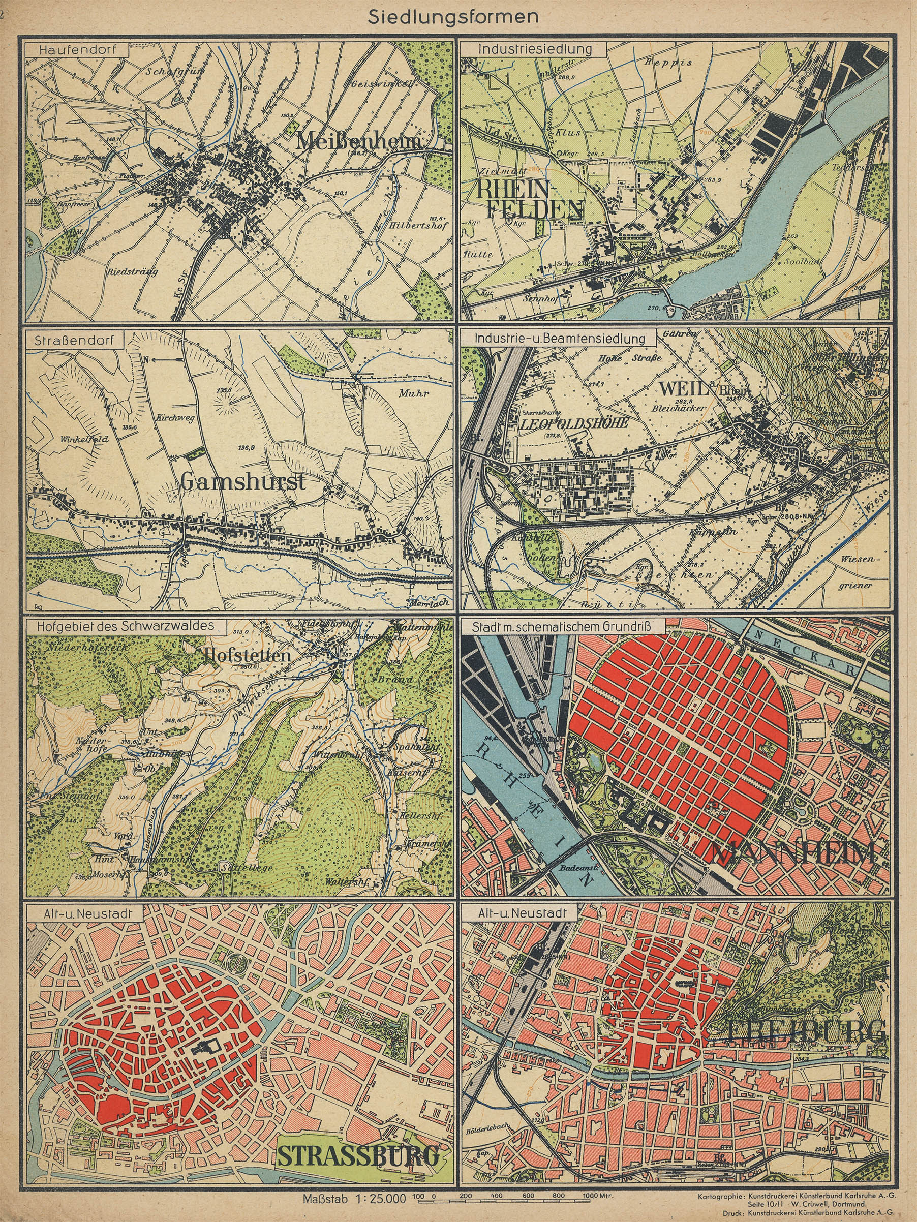
Siedlungsformen
Editions of the Atlas were published in 1942 and 1943. Several of the regional Atlases were published as late as 1944. By 1945, of course, a collapsing German infrastructure was in no position to be publishing any schoolbook.
1. For a complete review of Nazi education see: Pine, Lisa. Education in Nazi Germany. New York: Berg, 2010.
2. Hitler laid out his philosophy of Lebensraum in Mein Kampf (the 1939 Murphy translation is available on Archive.org). For more information see Weinberg, Gerhard. The Foreign Policy of Hitler’s Germany: Diplomatic Revolution in Europe 1933–1936. Chicago: University of Chicago Press, 1970.
3. Reichsstelle für das Schul- und Unterrichtsschrifttum. Deutscher Schulatlas. Berlin: Gemeinschaftsverlag Deutscher Schulatlas-Verleger, 1942.
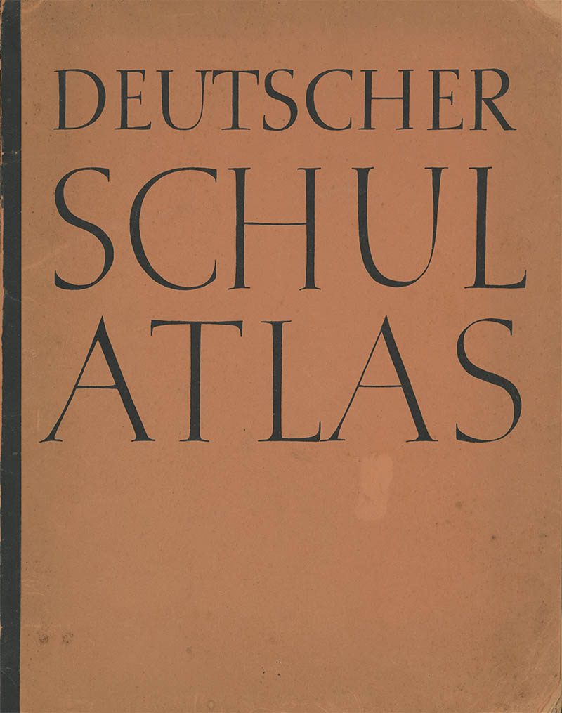
The Nazi’s banned Weimar-era modern typography in 1933, calling it culturally degenerate, and officially promoted the use of fraktur. In 1941 they, in turn, banned fraktur, and promoted the use of neo-classical Roman. This cover, designed by John Böhland, is a completely typical example. For more see: Aynsley, Jeremy. Graphic Design in Germany 1890–1945. Berkeley: University of California Press, 2000.
4. Reichsstelle für das Schul- und Unterrichtsschrifttum. Deutscher Schulatlas: Heimatteil Gau Baden. Berlin: Gemeinschaftsverlag Deutscher Schulatlas-Verleger, 1942.
29 May 2012 ‧ Cartography