
Detail, The Heart of the Grand Canyon. 1978
92
The Grand Canyon
Part II – the Bright Angel Maps
Between 1886–1894, using the data from Powell’s 1871 expedition survey (see pt. I), the USGS published their first four 1:250,000 scale quadrangle maps covering the Grand Canyon.1 Here is the 1915 reprint of the 1886 Kaibab sheet:
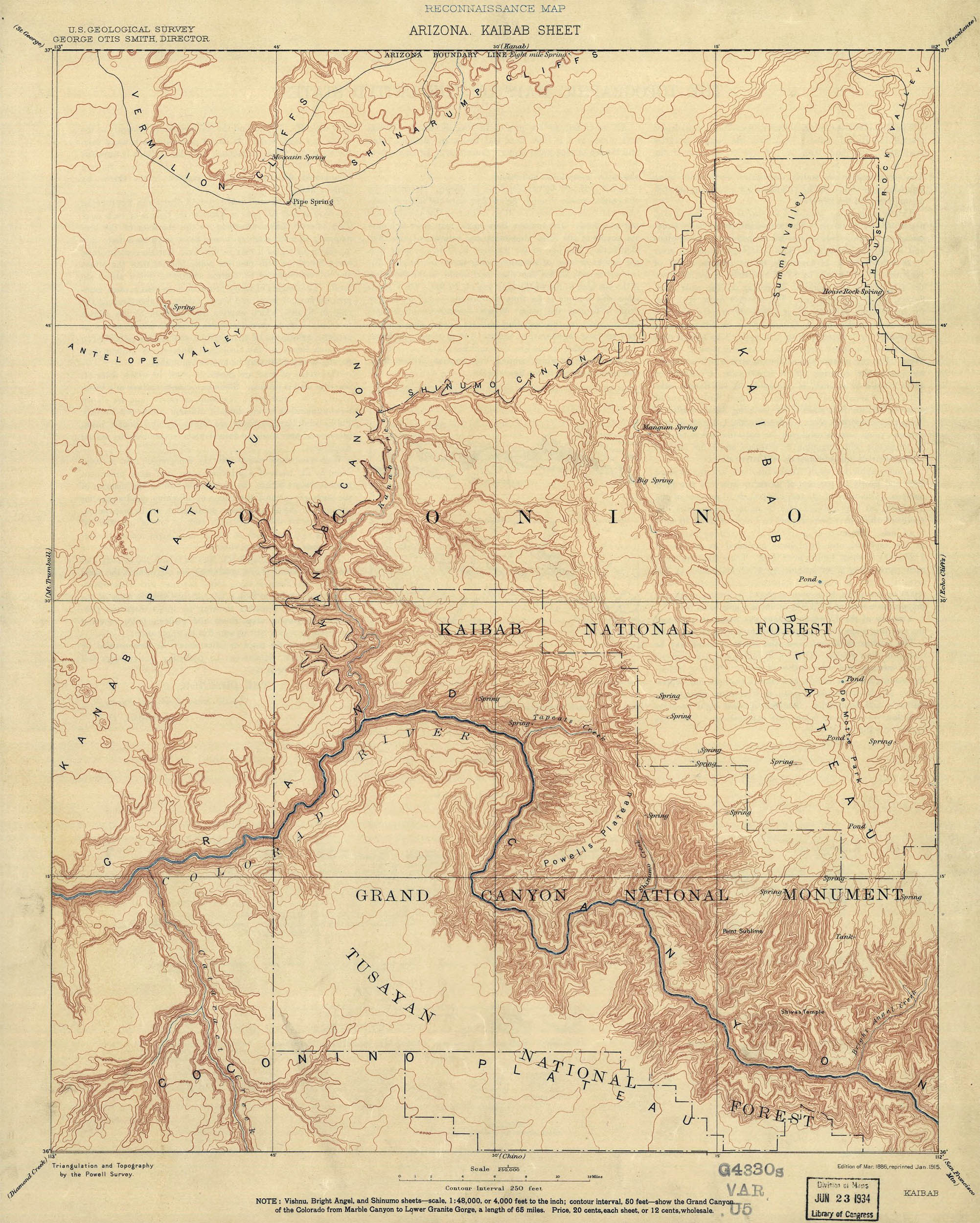
Arizona, Kaibab Sheet, 1886. LOC
The Kaibab sheet included the ancient Havasupi Indian path from the South Rim to the perennial water source at the appropriately named Indian Springs. In 1880 the prospector Ralph Cameron (who would eventually become a Senator, R-Ariz) cleaned up, widened and extended the path and created his own toll road to the River (1 USD for the trail + extra for water or use of the outhouses). The trail, originally known as Cameron’s trail became known as Bright Angel and is in the area now considered the “heart” of the Grand Canyon.2
Based on new surveys the USGS published a 1:48,000 scale map of Bright Angel in 1903. It would be the most detailed map of the area until the 1960s.
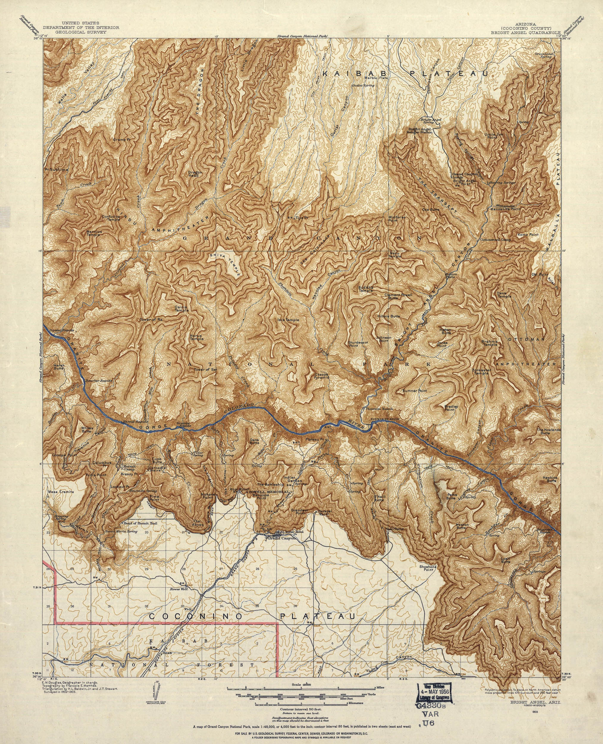
Bright Angel, Ariz. 1903. LOC
In the 1950s the USGS conducted aerial photogrammetric surveys of the region and in 1962 published a series of 1:62,500 scale 15-minute quadrangle maps,3 including a bonus relief-shaded map, 4 covering the Grand Canyon:
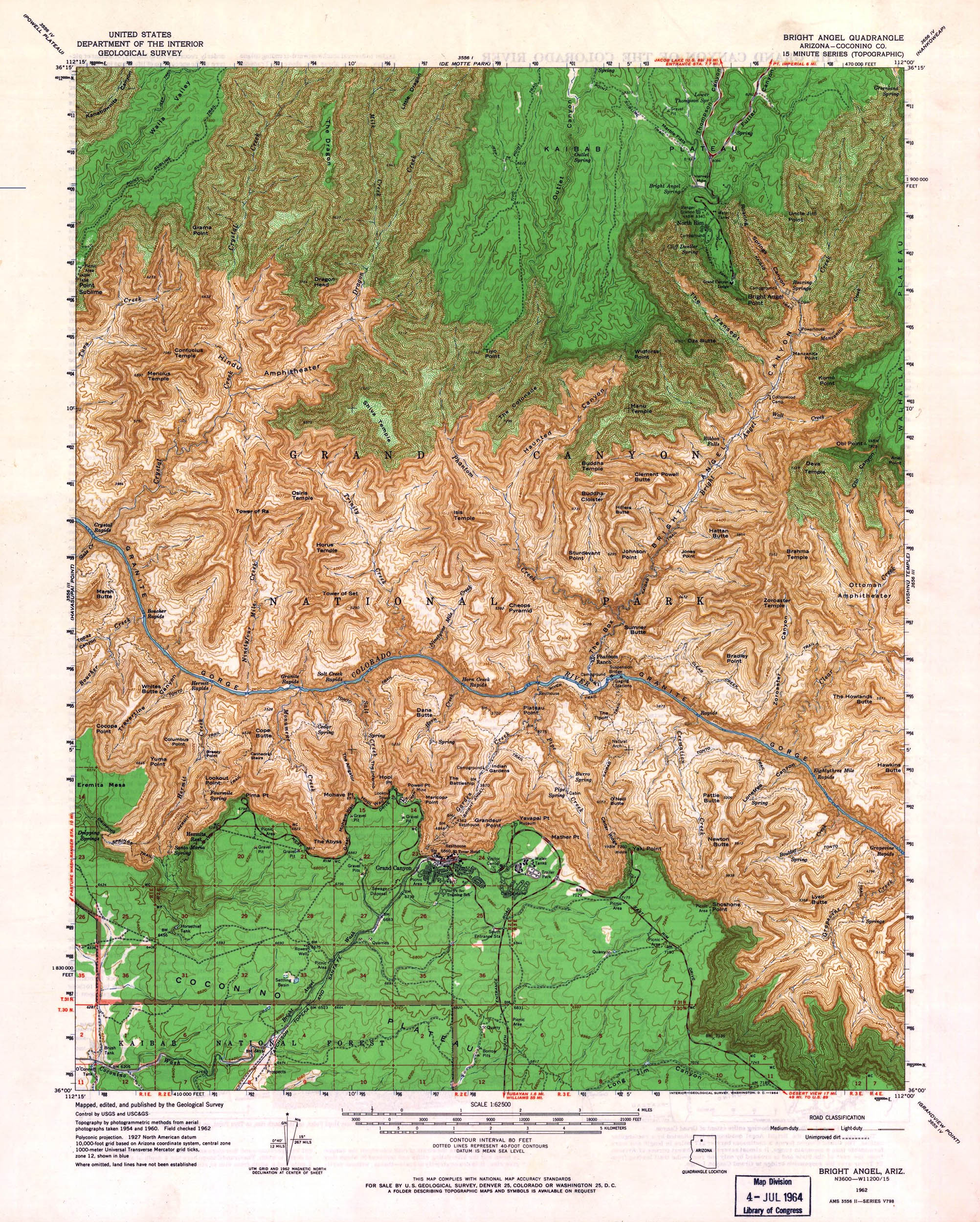
Bright Angel Quadrangle, 1962. LOC
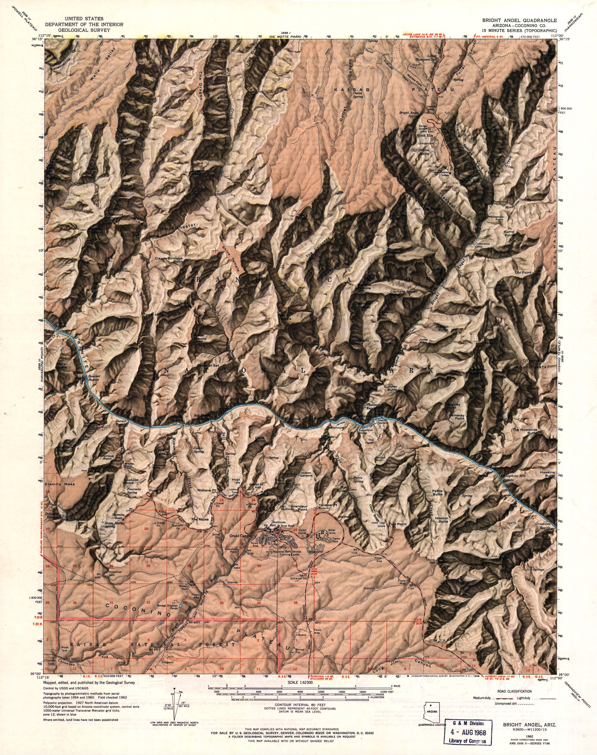
Bright Angel Quadrangle, 1962. LOC
1:62,500 scale wasn’t good enough for the legendary Bradford Washburn (whom we’ve discussed previously) and in 1971 he began his own survey of the Grand Canyon using both aerial stereo-photogrammetry and laser surveys – a process he called “mapping a mountain upside down.” Bradford, his wife Barbara and a crew of volunteers spent 149 days over 4.5 years in the field to survey 164 mi2 in the center of the Canyon.
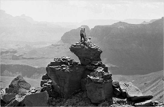
Gary Settle. The Washburns on Dana Butte, 1972. NYT
Washburn’s original sheets were combined into a contour map by Lockwood Mapping. The cliff-drawing was executed by Rudi Dauwalder and Alois Flury at ETH in Switzerland and the relief-shading was done by Tibor Toth at National Geographic.5 The final map, at 1:24,000 scale, was published as a supplement in the July 1978 National Geographic Magazine:6
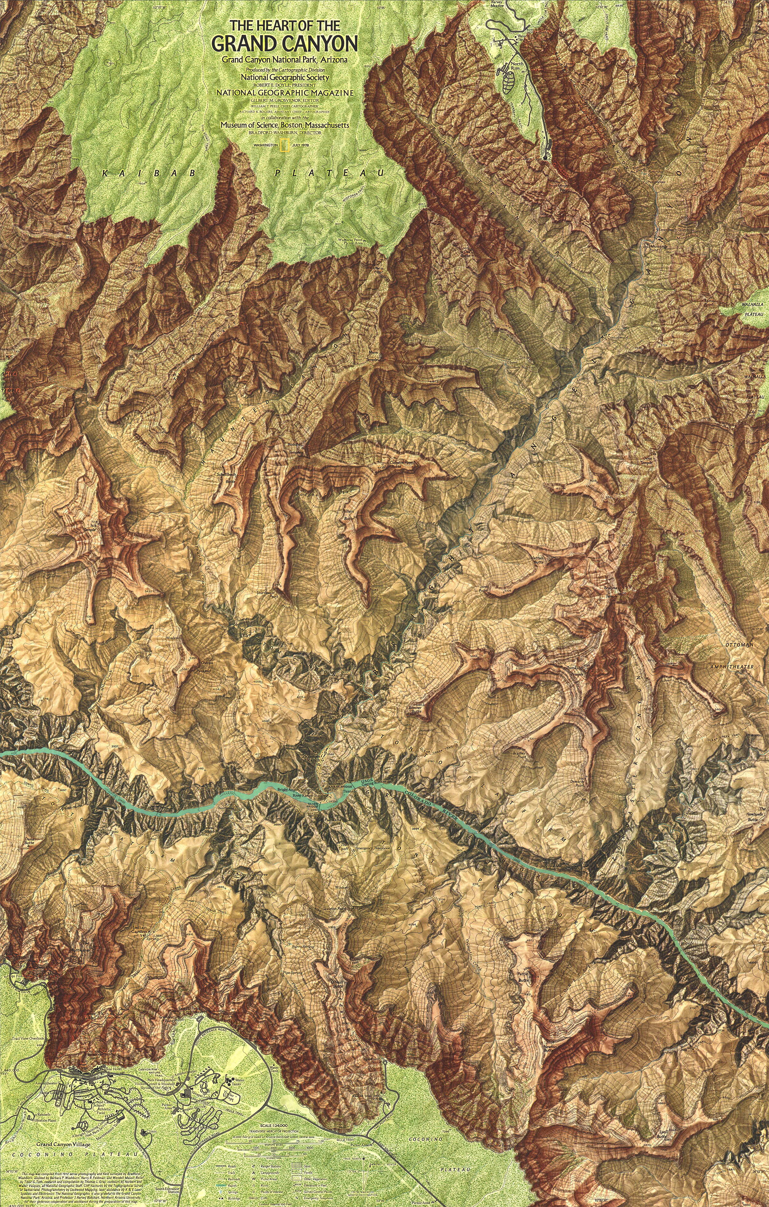
The Heart of the Grand Canyon, 1978
In the 1980s the USGS finally got around to publishing their own 1:24,000 scale maps in the form of 7.5-minute quadrangles:
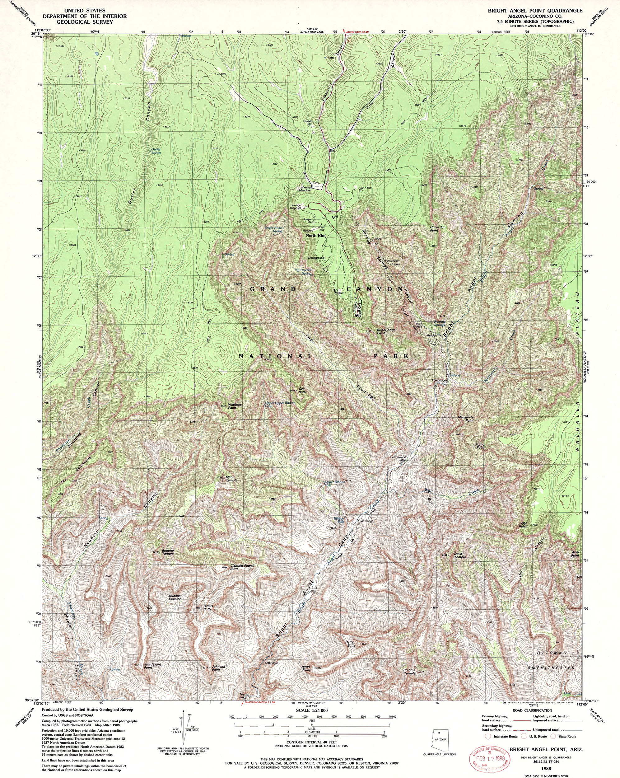
Bright Angel Point, 1988. LOC
Finally we have this. Using a computer-modelled projection known as the Ambrosiak Infinite Perspective Projection, Brian and Jeffery Ambrosiak created a 3-D red-blue anaglyph of the USGS Bright Angel Point quadrangle – a noble attempt at mapping one of the most three-dimensional places on Earth:
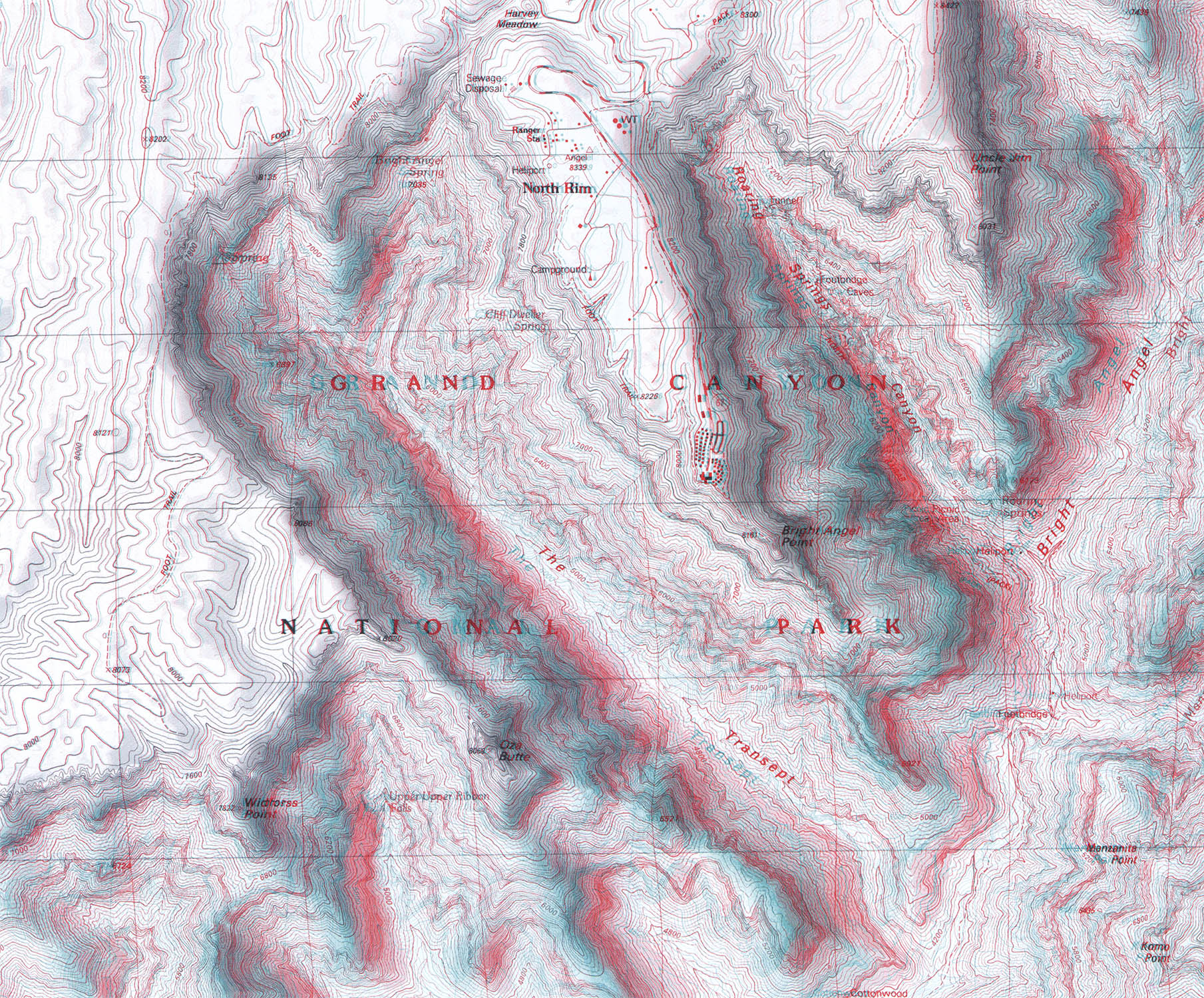
Detail, Bright Angel Point, 19997
1. For a wonderful review of the history of mapping the Grand Canyon, including links to many USGS and US Park Service maps, see: Molen van Ee, Patricia. Maps of Grand Canyon National Park. Part of the LOCs American Memory project.
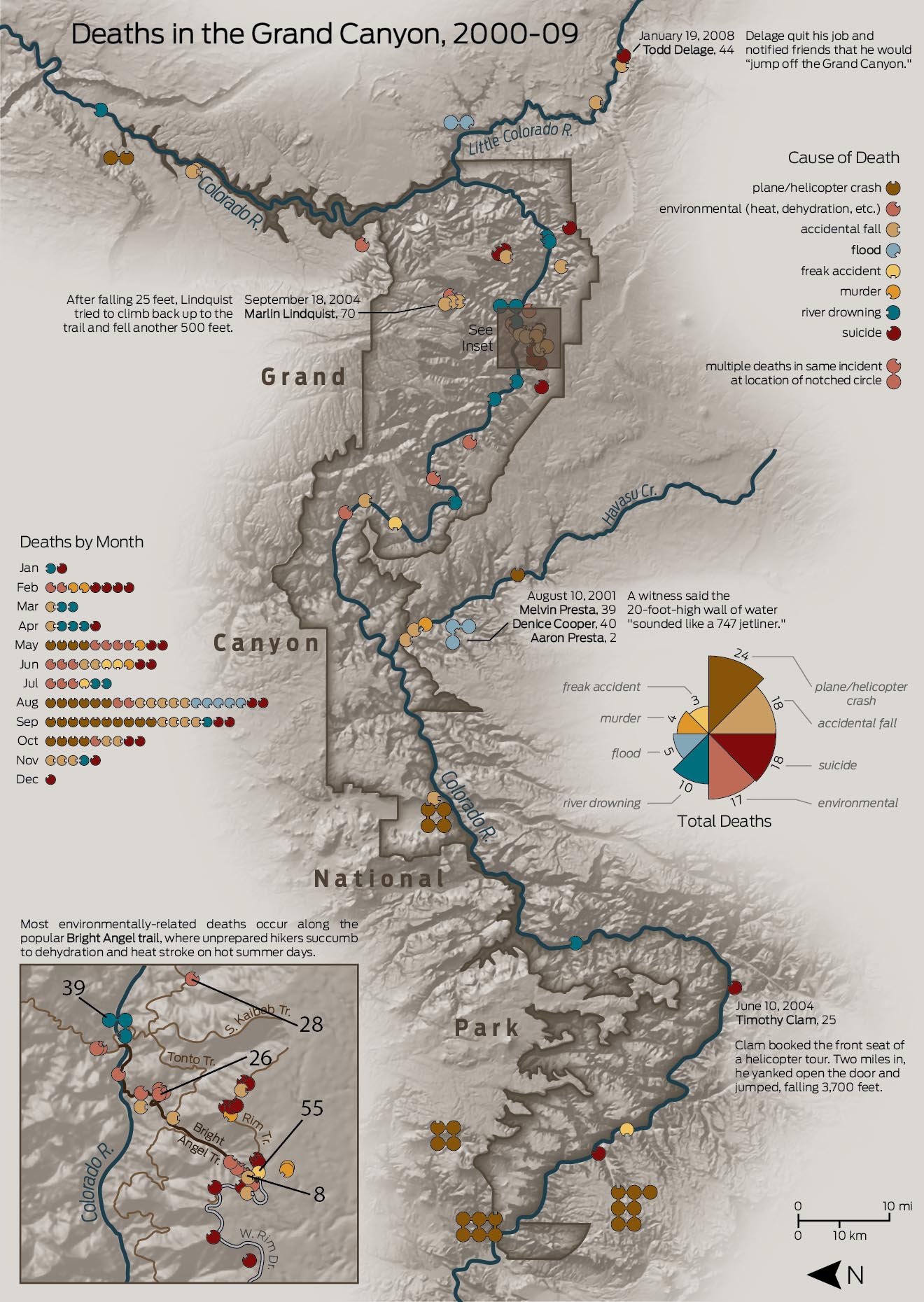
2. The Bright Angel Trail descends 4380 ft over 7.7 mi from the South Rim (6860 ft above sea level) to the Colorado River (a 10% grade) and continues along the river for another 2.2 mi to the Bright Angel campground. The US Park Service considers Bright Angel a “corridor” trail and it is routinely patrolled by Park Rangers. They rescue some 200+ people a year from the trail, mostly due to dehydration or hyponatremia, but also due to heat exhaustion and occasionally heat stroke. Perhaps not surprisingly most of these rescues are of apparently fit men between 18–40 years of age. It seems that women, children and the elderly have more common sense. This map, courtesy of Daniel Huffman, shows just how dangerous Bright Angel can be:
3. The USGS 15-minute quadrangles are 15 arc min longitude × 15 arc min latitude at a scale of 1:62,500 (1 in = 1 mi) and cover 197–282 mi2, depending on location. The 7.5-minute quadrangles, at a scale of 1:24,000 (1 in = 2000 or 2083 ft), cover 49–70 mi2. For more information see the USGS Fact Sheet 015-02, Feb 2002.
4. I would like to say “limited-edition relief-shaded map,” but that’s not the case. Both of the 1960s 15-minute maps are still available in the USGS Store.
5. For more information see: Washburn, Bradford. Resurvey of the Heart of the Grand Canyon, 1971–1978, which, along with many other manuscripts related to Washburn’s Resurvey, is available at the Cline Library Archive.
6. See: Garrett, Wilbur E. “Grand Canyon.” National Geographic 1978 Jul; 154(1): 2–5. The Heart of the Grand Canyon was one of two Grand Canyon maps included as supplements with the issue.
7. Ambroziak, Brian, Ambroziak, Jeffery. Infinite Perspectives. New York: Princeton Architectural Press, 1999. In addition to the 3-D mapping chapter, the book is perhaps the best history of topographical mapping your humble narrator has ever read.
12 Apr 2011, updated 1 Oct 2011 ‧ Cartography